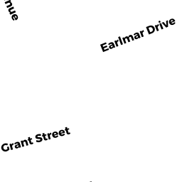
35 EARLMAR DR
Owner Information
MCINERNEY MARK E + SUSAN M
35 EARLMAR DR
N ATTLEBORO, MA 02760


Property Details
35 EARLMAR DR is classified as a Single Family Residential (Ranch).
The primary structure on this property was built in 1955. There are 2,912ft2 of built area within this property. There is 1,396ft2 of residential/living space within this property.
35 EARLMAR DR is valued at $390,500. The land is valued at $127,800 and the structures are valued at $259,300. There is an additional valuation of $3,400 on this property.
The most recent deed for 35 EARLMAR DR is recorded at the local registrar in Book 05353, Page 0120. 35 EARLMAR DR was last sold on Monday, January 4, 1993 for $112,000.
Assessment data from fiscal year 2022.
Flood Data
According to the FEMA National Flood Hazard Layer, this property does not appear to be in a flood zone. It may also be in an area not yet reviewed. Nonetheless, confirm this information prior to taking any action.
To view the flood hazards around this property, create a FEMA "Firmette" Map of the area around 35 EARLMAR DR.
Broadband Internet Providers
| Provider | Type | Bandwidth (mbps) | |
|---|---|---|---|
| VSAT Systems, LLC. | Satellite | 2 | 1 |
| Verizon New England Inc. | Fiber | 940 | 880 |
| Comcast | Cable | 1000 | 35 |
| Viasat Inc | Satellite | 100 | 3 |
| T-Mobile | Fixed Wireless | 25 | 3 |
| GCI Communication Corp. | Satellite | 0 | 0 |
| HughesNet | Satellite | 25 | 3 |
| Verizon New England Inc. | DSL | 15 | 1 |
Broadband service provider data from December 2020.
Adjacent Properties
- 41 EARLMAR DR
Single Family Residential owned by LAGOR JASON + BLANCHETTE NICOLE - 27 EARLMAR DR
Single Family Residential owned by MORIN MARK W II + COLLEEN E - 42-42 SECOND AVE
Other, Open Space owned by None - 42 SECOND AVE #32
Condo NL MDL-05 owned by ROGERS PATRICK + WARD ERIN K - 42 SECOND AVE #19
Condo NL MDL-05 owned by LEBLANC DENISE A + BERNADETTE - 42 SECOND AVE #27
Condo NL MDL-05 owned by SHUMAN WILLIAM H + LORAINE F - 42 SECOND AVE #9
Condo NL MDL-05 owned by LECA MARLENE C - 42 SECOND AVE #40
Condo NL MDL-05 owned by TUON HAYLEY + NEANG - 42 SECOND AVE #7
Condo NL MDL-05 owned by ALMEIDA TROY + LOVETT KATIE - 42 SECOND AVE #16
Condo NL MDL-05 owned by BEAUPRE CHRISTOPHER R - 42 SECOND AVE #14
Condo NL MDL-05 owned by ZHANG XIAOLAN + FAN JIAMIN - 42 SECOND AVE #13
Condo NL MDL-05 owned by STUART JAMES A - 42 SECOND AVE #33
Condo NL MDL-05 owned by KENNEDY JEFFREY F - 42 SECOND AVE #2
Condo NL MDL-05 owned by PLANT MELISSA + EBERLEE JOSHUA W - 42 SECOND AVE #34
Condo NL MDL-05 owned by KELLY COURTNEY - 42 SECOND AVE #25
Condo NL MDL-05 owned by REILEY JAMES M + RYMARCZYK S L - 42 SECOND AVE #29
Condo NL MDL-05 owned by BOORY TAMMY L - 42 SECOND AVE #21
Condo NL MDL-05 owned by LELIEVRE SANDRA C - 42 SECOND AVE #10
Condo NL MDL-05 owned by TREWEEK ANGELINA M - 42 SECOND AVE #1
Condo NL MDL-05 owned by JOHNSON RAMONA Y - 42 SECOND AVE #26
Condo NL MDL-05 owned by EBERSOLE THOMAS + JESSICA CELINA - 42 SECOND AVE #24
Condo NL MDL-05 owned by CHARNLEY KENNETH J II + SHOCKRO M - 42 SECOND AVE #30
Condo NL MDL-05 owned by DAMATA MADELINE - 42 SECOND AVE #18
Condo NL MDL-05 owned by LYNCH JAMES M + LUCIANO KIM R - 42 SECOND AVE #36
Condo NL MDL-05 owned by BURNS KIMBERLY J - 42 SECOND AVE #12
Condo NL MDL-05 owned by FUMAROLA MELISSA A - 42 SECOND AVE #39
Condo NL MDL-05 owned by HARBOUR DONNA J - 42 SECOND AVE #5
Condo NL MDL-05 owned by MCQUADE JUDI L - 42 SECOND AVE #6
Condo NL MDL-05 owned by PERRY GEWNDOLYN - 42 SECOND AVE #22
Condo NL MDL-05 owned by JOHNSON ROBERT J SR + KATHLEEN - 42 SECOND AVE #17
Condo NL MDL-05 owned by MEDEIROS MARK K JR - 42 SECOND AVE #37
Condo NL MDL-05 owned by MACAIONE TODD M TRS MACAIONE LIVING TRS - 42 SECOND AVE #23
Condo NL MDL-05 owned by CARCAMO LUIS A SANDOVAL + VEGA-PIVARAL B - 42 SECOND AVE #11
Condo NL MDL-05 owned by TALENTINO EMILY LOUISE - 42 SECOND AVE #35
Condo NL MDL-05 owned by BRENNAN KARA J - 42 SECOND AVE #31
Condo NL MDL-05 owned by MOATS MORGAN L + BESTWICK JASON A - 42 SECOND AVE #15
Condo NL MDL-05 owned by LITTIG JOSEPH W - 42 SECOND AVE #28
Condo NL MDL-05 owned by HALLAHAN KATHLEEN - 42 SECOND AVE #8
Condo NL MDL-05 owned by AYOUB FRANCISCA S + MICHAEL M - 42 SECOND AVE #38
Condo NL MDL-05 owned by HAJDUK DENNIS J TRS HAJDUK FAMILY NOM TR - 42 SECOND AVE #20
Condo NL MDL-05 owned by FONG CHRISTOPHER - 42 SECOND AVE #3
Condo NL MDL-05 owned by HEIDKE GAIL - 42 SECOND AVE #4
Condo NL MDL-05 owned by OBRIEN MARK J + CYNTHIA M